
Aurora Past Resident Sources by Era
The record trail for previous residents changes with the age of the address. The table uses real local years located in the Aurora research, not a promise of continuous coverage. Where an index, scan, or cutoff was not exposed, the access caveat stays visible. Start with the current parcel, then move to the source that covers the era in question.
| Source | Real local years | What it shows | Access caveat |
|---|---|---|---|
| Arapahoe official records | Portal verified through 07/29/2026; start year not displayed | Recorded parties, instruments, dates, legal clues and OCR option | Historical start and a stable live image sample [not located] |
| Adams LandmarkWeb | Current; historical extent [not located] | Reception, index and images for Adams-side Aurora | Some copy and certification routes are office-based |
| Douglas LandmarkWeb and Image Express | Current portal plus 1800s historic books at research stations | Grantor, grantee, book/page, instrument and legal description | Some historic records are not online; staff do not perform open-ended research |
| Aurora city documents | 2004 plat; 2011 quitclaim; 2013-2017 permits; 2022 permit sample | Permit, plat, deed and document metadata tied to an address or quarter-section | City index is a lead; verify the official document and disclaimer |
| LOC Aurora telephone directory | Winter 1936/37 through May 1947 | Subscriber, phone, street address, business and yellow-page context | Digitized, but not every person had a listing |
| Aurora History Museum bibliography | 1930, 1939, 1941, 1948, 1952, 1953, 1955, 1957, 1959, 1962, 1972-73 | Local and suburban directory titles and year targets | Many are citations or physical holdings, not free scans |
| DPL householder and criss-cross runs | Denver 1924-2018; 1924-1937 digitized | Address-to-occupant or owner clues for covered geography | Denver coverage; confirm an Aurora or suburban volume first |
| Federal census | 1950 released; 1960 not yet released at inspection | Household on the census date, ages, relationships and origin fields | Boundary and census-date differences; not current |
| Sanborn fire maps | Aurora 1926; DPL inventory identifies 1937 and 1937 update/1942 local coverage | Building footprint, use, material, story count and street context | Maps are not ownership records; later access needs verification |
| Aurora History Museum collections | Local finding aids; year runs not fully enumerated online | Photographs, neighborhood, institutional and oral-history context | Specific request, supervised appointment, possible research or reproduction fee |
The previous residents of a parcel may appear first in a deed, while the people who actually occupied it appear in a directory, census, obituary, or local collection. Treat each source as one layer of a house history and record its date, geographic scope, and access status.
Current Aurora Resident History to the Deed
Begin with the current assessor owner and the parcel's stable land keys. Aurora's city property map can confirm city limits, county, parcel ID, subdivision, lot, block, quarter-section, annexation ordinance, permits, and public-document links. The county assessor then supplies the AIN or PIN, owner field, situs and mailing addresses, legal description, value or tax context, and map link. The Arapahoe parcel search accepts AIN, PIN, and address modes. Its address mode separates number, range, street name, and unit, and tells the user not to enter a direction or street type there.
An assessor mailing address is a tax-notice destination, not proof that the named owner lives at the parcel. It can point to an address outside Aurora, a post-office box, a trust, business, estate, or prior address. The physical situs and legal description are the better bridge to a recorded instrument.
The Arapahoe current sales history shows the fields that connect a current parcel to past transactions, including AIN, address, PIN, book page, sale date, and sale price.
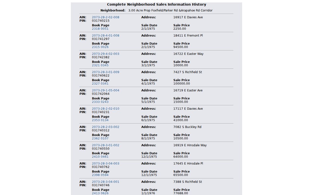
A sales-history row is a lead to the deed and does not replace the recorded instrument. Preserve the parcel identifier and book-page clue before moving to the recorder.
- Confirm the address in the Aurora map and note the county, parcel ID, AIN or PIN, legal description, and annexation context.
- Open the current assessor result and write the owner, mailing line, situs, lot, block, subdivision, and tax year.
- Search the county recorder for the current owner as grantee, using the legal description and a narrow date range.
- Open the purchase deed, identify the seller or grantor, and carry the same lot, block, subdivision, or legal-description wording backward.
- Repeat the seller-as-grantee search for the earlier transfer. Separate deeds of trust, releases, quitclaims, estate deeds, and replat documents from fee-title transfers.
Aurora Resident Deed Chains Use Land Keys
The fastest backward trail follows the seller as the next historical grantee. A street address is a clue, but legal description, parcel ID, reception or instrument number, plat, lot, block, and subdivision wording survive changes in street labels more reliably. The chain can branch through refinancing, releases, quitclaims, survivorship changes, estate or personal-representative deeds, and subdivision replats. Read the instrument type before calling a name change a transfer of complete title.
- Grantor
- The party transferring or conveying an interest in the recorded instrument.
- Grantee
- The party receiving the interest named in the instrument.
- Chain of title
- The linked sequence of recorded transfers that connects a later owner to earlier parties.
- Legal description
- A land description using lot, block, subdivision, quarter-section, or metes and bounds instead of only a street number.
If the Arapahoe online index stops or an image is not online, use the Clerk and Recorder contact, office research station, older deed books or microfilm, and a specific public-record request. The online historical start year was not located in the official sources. Arapahoe lists clerk@arapahoegov.com and 303-795-4200, and its office page gives weekday hours with appointment notes effective in 2026.
Adams and Douglas Recorders Differ from Arapahoe
Aurora crosses county lines, so the previous residents of an address may be hidden by a wrong recorder choice. Adams LandmarkWeb offers Name, Document, Book/Page, Consideration, Record Date Range, Reception Number, and Legal Search modes. It provides non-watermarked online copies without a login, while certified copies route through the office at 4430 South Adams Parkway. Adams assessor and GIS records are separate and their full historical cutoff was not located.
Douglas LandmarkWeb offers Name, Document, Book/Page, Consideration, Record Date Range, Instrument Number, and Legal Search modes. Douglas indexes names Last, First, treats companies as document parties, and warns that street addresses are not indexed. Lot and subdivision legal descriptions are the reliable key. The county recommends one-to-five-year date ranges. Staff can locate a book or page, but will not perform open-ended chain research. Douglas Image Express research stations hold some 1800s material, which makes an office or research-station visit important for older past residents.
The Douglas recording guide explains the deed-chain mechanics, research stations, historical books, copy routes, and the warning that some records remain offline.
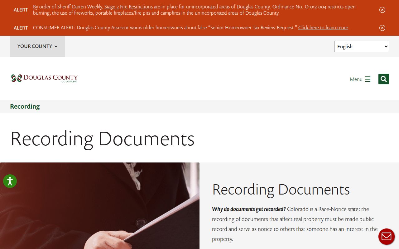
The guide is a practical contrast with Arapahoe's open historical start-year gap. Route by county polygon first, then search the correct name and land key.
The Douglas LandmarkWeb recorder is the county's online index route for current recorded instruments and the search modes described above.
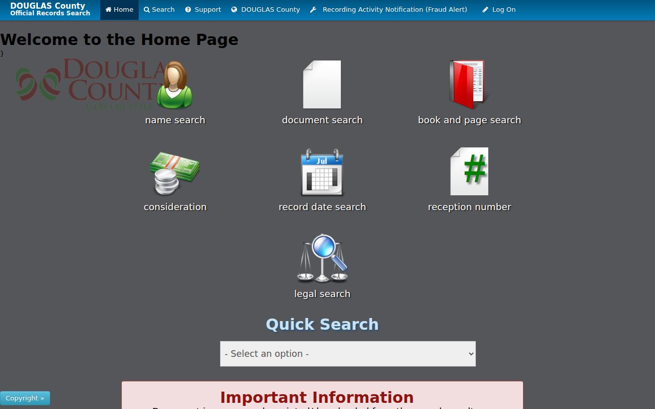
The LandmarkWeb capture belongs to the Douglas branch of the Aurora address trail, not to an Arapahoe or Adams parcel search.
Douglas publishes its own recording fees, including a $43 standard recording fee, $0.25 per online copy page, $1 per certification, and listed shipping tiers. Those figures apply to Douglas, not Arapahoe or Adams. The inspected research did not locate a current Arapahoe or Adams image and certified-copy fee schedule, so those amounts should not be transferred across counties.
Aurora Past Residents in the 1926 Sanborn
The Library of Congress Aurora Sanborn record identifies an Aurora, Adams and Arapahoe Counties map from June 1926 in only two sheets. A map sheet can show a structure before a modern parcel layer, including footprint, material, story count, use, nearby streets, and lot context. It cannot prove ownership or identify every household.
The Denver Public Library fire-insurance-map inventory adds Aurora 1937 and a 1937 update or 1942 local entry. Those later records need access verification, but they provide an era bridge when a deed chain or street number is hard to read. Match the map's street and lot context to the county legal description rather than assuming a current address label existed in 1926.
This two-sheet story is an interest clue for an old Aurora house: a compact map can date the built setting before modern GIS, while the recorder supplies the legal transfers. Keep both sources in the time line and name what each one cannot show.
Aurora Directory Years Fill the Middle
The strongest fully digitized local directory run is the Library of Congress title Colorado White Pages and Yellow Pages, Aurora, Winter 1936/37 through May 1947. It offers text, images, and PDF catalog access. A local row can include a subscriber or business name, telephone number, street address, and residence or classification notation. OCR can break columns, so check the page image.
The Aurora History Museum bibliography identifies a 1930 Annual Directory, 1939 Aurora Telephone and Mountain Bell, 1941 XL Directory of Aurora Section B, 1948 Complete Directory of Aurora, 1952 Aurora Directory, 1953, 1955, 1957, 1959 and 1962 city-directory citations, a 1962 Denver Combined Suburban Directory, and a 1972-73 Denver Suburban Directory. These are real year targets, but a bibliography is not a promise of a free scan. Ask the museum or library whether a physical or digital volume is held.
Denver Public Library's Colorado Directories Index can be searched by municipality, county, and year. Its Denver householder and criss-cross runs cover Denver from 1924-2018, with 1924-1937 digitized, and its house-history guide lists Denver property and directory resources. The Denver caveat is essential: a regional suburban volume may include Aurora, but a Denver city or Denver address run cannot be silently extended to every Aurora parcel.
The DPL house-history guide shows the research method and the geographic caution.
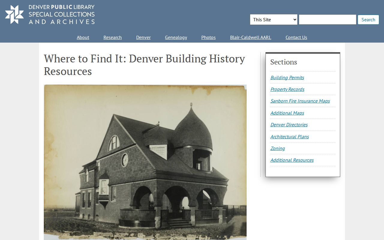
Use a directory row to test who was listed at an address during a publication period. Use a deed to test ownership, a census to test the household on an enumeration date, and an obituary or probate file to test a later life event.
Permits Date an Aurora Resident Address
Aurora's public-document search accepts address, subdivision, and quarter-section modes. Visible local samples include a 2004 Aurora Reservoir subdivision plat, a 2011 Quit Claim Deed, permit rows at 20308 East Coolidge Drive from 2013-2017, and a 2022 commercial building permit at 26100 East 68th Avenue. Result fields include an ID, title, release date, size, extension, keywords, and view control. The city says the index is under development and that information may not be official, so treat each row as a lead to the custodian document.
The building-permit REST layer adds permit and folder numbers, dates, descriptions, condition, valuation, property record, address, coordinates, and property roll fields. A permit applicant or contractor is not necessarily an owner or resident. A plat can explain a new subdivision, while a quitclaim can explain a name or interest change without showing the whole chain.
For an underlying city document, use the city public-records route or a specific CORA request with the address, quarter-section, ID, date range, and preferred format. CORA is the Colorado Open Records Act, C.R.S. §24-72-102 et seq.; public-safety material follows the CCJRA, C.R.S. §24-72-301 et seq. This is where web access, email or phone contact, written or mailed request, and a city counter or records custodian supplement the online index.
Pair Aurora Directories with Census Years
Directories and census schedules answer different time questions. A directory can place a subscriber at a printed address during a publication run. A census records a household on its enumeration date, with ages, relationships, and other fields. As of the 2026 inspection, the 1950 census was released under the 72-year rule and the 1960 census was not yet released. Do not turn a directory presence into proof of a census-day household, or a census household into a current address.
- Copy the exact address, street direction, city label, source title, year, page, and listing type from the latest confirmed directory.
- Search the preceding directory or criss-cross volume, trying abbreviated street types, omitted directions, renamed streets, cross streets, and the nearby subdivision.
- Place the directory date beside the nearest released census year and compare names, ages, relationships, and address geography.
- Use the deed or assessor record to separate owner from occupant, then use permits, newspapers, obituaries, and probate to explain a move or death.
- Keep uncertainty when a scan, page, county boundary, or address conversion cannot be verified.
Older Aurora development names can change the search. Colfax and trolley corridors, Fitzsimons, Lowry, Buckley, Aurora Reservoir, DeLaney Farm, and east or southeast subdivisions are useful anchors, but they are not interchangeable legal jurisdictions.
Aurora Resident Obituaries and Probate
Obituaries, funeral indexes, cemetery records, and probate files can explain what happened after a directory row or deed. Aurora Public Library's research gateway points to the Colorado Historic Newspapers Collection, genealogy and history databases, and newspaper resources. Denver Public Library holds Colorado obituary scrapbooks from 1934-1963, the Colorado Statesman index, and funeral-home material. Search a surname with Aurora, Colfax, Fitzsimons, a subdivision, or a street name, then read the page image because OCR can fail.
Probate belongs to the correct county and district court. A public petition may name heirs, a personal representative, an estate address, or a later residence, but protected pages or redactions can remain. Pair the probate clue with the deed chain and an eligible death record. A cemetery name is not a death certificate, and the inspected sources did not locate a consolidated citywide Aurora interment-name database.
The result is a layered endpoint: directory for a listing, deed for a transfer, census for a household, obituary for a life event, probate for heirs, and vital or court records for the official eligible copy. That separation keeps previous residents distinct from unsupported conclusions about a living person.
Aurora Resident Archives Grew from Preservation
Aurora's local record story includes a human clue. The first Aurora library began in Sarah Wood's home at 1516 Dallas Street in 1929. Formal city-record preservation became organized in 1977, and library responsibility for the archives followed in 1985. A missing web result may therefore be a finding-aid or box problem rather than proof that a photograph, neighborhood file, oral history, or institutional record never existed.
The Aurora History Museum archival research route offers finding aids, supervised appointments, research requests, and reproduction service. Name the person, address, neighborhood, business, institution, or event, and allow up to two weeks. The museum lists 15151 East Alameda and 303-739-7000; exact research and reproduction fees were not located.
Aurora Public Library, DPL Western History, Colorado State Archives, the Aurora Genealogical Society, and the Aurora FamilySearch Center each hold a different layer. Use web catalogs first, then email, phone, mail, library stacks or microfilm, archive appointments, and office counters where the record keeper requires them. Ask for a title, year, repository, and page citation instead of a broad search.
Past Aurora Households Need Careful Boundaries
Previous residents research is for house history, family history, genealogy, and personal curiosity. The evidence should be dated, tied to the right county, and limited to the public record needed for the question. A directory subscriber may be a business, institution, or one person in a household. A deed party may be a trust, lender, spouse, estate, or representative. A map may show a structure without naming anyone.
Keep the backward chain, household layer, and life-event layer in separate notes. If the record trail ends, say why: Arapahoe's online start year was not displayed, a DPL volume may be Denver-only, a Sanborn map is not ownership proof, or a museum collection needs a supervised request. Those gaps are part of an honest Aurora address history.
Lawful use. Research into Aurora previous residents is for lawful house history and family history. A public record is not permission to stalk, harass, threaten, monitor, or intimidate a living person.