
Aurora ZIP Code Directory Coverage
The Aurora postal reference combines the current USPS DMM L012 label-list file effective 2026-07-01, an official historical USPS DMM list, USPS station evidence, and Aurora address examples. The broad area descriptions are orientation aids. A label-container group is not a street-by-street boundary map, and the exact delivery assignment should be checked with USPS before a county record is routed.
| ZIP | Broad Aurora area/use | Post office/station evidence | Notes/boundary mismatch |
|---|---|---|---|
| 80010 | Older central/northwest Aurora and east-Colfax core | Hoffman Heights, 738 Peoria St., Aurora 80011-9995, lists 80010 as an alternate route | Check the city/ZIP line; current DMM groups 80010 with 80011, 80040, 80041, 80045 |
| 80011 | Central/northeast/east-Colfax and Fitzsimons/Anschutz-side corridor | Altura, 15355 E Colfax, Aurora 80011-9998; Hoffman Heights also serves an 80011 last line | USPS group includes 80010, 80040, 80041, 80045; 80045 is distinct for some institutional deliveries |
| 80012 | Central/east Aurora | Hoffman Heights page lists 80012 as an alternate | Current DMM groups 80012 with 80014 and 80044; exact street boundary [not located] |
| 80013 | Eastern/southeastern residential Aurora | Official historical USPS DMM lists 80013; a current stable station page was not located | Regular Aurora ZIP from historical DMM and city address evidence; current label-list row [not located] |
| 80014 | Southeast Aurora, Gateway, and adjacent southeast routes | Gateway, 2500 S Abilene, Aurora 80014-9998, lists 80014 as a last line | Current DMM groups 80014 with 80012 and 80044 |
| 80015 | Far southeast and Cherry Creek-side Aurora | [RESEARCH GAP: station page not isolated] | Current DMM groups 80015 with 80046; exact city-line overlap [not located] |
| 80016 | Southeast Aurora and Aurora Reservoir-side growth | [RESEARCH GAP: station page not isolated] | Regular Aurora ZIP in city/property examples and historical USPS materials; exact assignment [not located] |
| 80017 | East Aurora and Alameda-side corridor | Aurora, 16890 E Alameda, Aurora 80017-9998 | Current DMM groups 80017 with 80018, 80019, 80042, and 80047 |
| 80018 | Far east Aurora and Aurora Highlands-side growth | [RESEARCH GAP: station page not isolated] | Current DMM grouping is Aurora 80017-80019/80042/80047; broad area only |
| 80019 | Northeast/eastern growth and Gateway-side routes | [RESEARCH GAP: station page not isolated] | Current DMM grouping is Aurora 80017-80019/80042/80047; exact boundary [not located] |
| 80040 | Auxiliary/route container associated with Aurora 80010/80011 | Current DMM label list groups 80040 with Aurora 80010-80011 | Exact delivery area or PO-box/unique-use status [not located]; do not map it as a neighborhood |
| 80041 | Auxiliary/route container associated with Aurora 80010/80011 | Current DMM label list groups 80041 with Aurora 80010-80011 | Exact delivery area/status [not located] |
| 80042 | Auxiliary/route container associated with Aurora 80017-80019 | Current DMM label list groups 80042 with Aurora 80017-80019 | Exact delivery area/status [not located] |
| 80043 | Historical auxiliary range entry | Historical USPS DMM lists the Aurora 80040-80047 range; current L012 row did not expose 80043 | [RESEARCH GAP: current official service/post-office status not located] |
| 80044 | Auxiliary/route container associated with Aurora 80012/80014 | Current DMM label list groups 80044 with Aurora 80012/80014 | Exact delivery area/status [not located] |
| 80045 | Fitzsimons/Anschutz or another unique/institutional last line | Current DMM groups 80045 with Aurora 80010/80011; 2006 USPS Bulletin records 29 deliveries moved from 80010 | Distinct postal last line, not a simple city-neighborhood ZIP |
| 80046 | Auxiliary/route container associated with Aurora 80015 | Current DMM label list groups 80046 with Aurora 80015 | Exact delivery area/status [not located] |
| 80047 | Auxiliary/route container associated with Aurora 80017-80019 | Current DMM label list groups 80047 with Aurora 80017-80019 | Exact delivery area/status [not located] |
The regular 80010 through 80019 rows belong at the center of an Aurora postal directory. The auxiliary 80040 through 80047 rows need a different reading. They are route or last-line identifiers in the USPS grouping, and the research did not locate enough evidence to redraw them as residential neighborhood boundaries.
Current USPS Groups for Aurora ZIP Codes
The current USPS DMM L012 label list groups 80010, 80011, 80040, 80041, and 80045 together; 80012, 80014, and 80044 together; 80015 with 80046; and 80017, 80018, 80019, 80042, and 80047 together. The effective date is 2026-07-01. This is a postal routing update, not an Aurora annexation map.
The historical USPS list is useful for confirming the regular 80010-80019 set and the auxiliary 80040-80047 range. The historical DMM listing should be read as a period label reference. It does not resolve each current street assignment, and it does not supply county parcel jurisdiction.
The distinction matters when a search begins with a ZIP. Postal last lines can group an institution, a route, a station, and a city address in one row. Use the exact delivery address with USPS, then use the parcel polygon and county field to select Arapahoe, Adams, or Douglas records.
The historical USPS DMM screen behind the regular and auxiliary range gives a useful check on the table above.
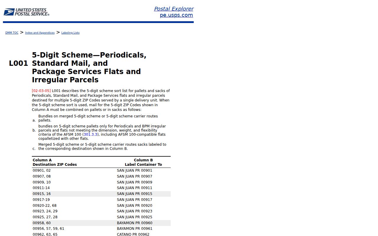
The historical list confirms the postal vocabulary, while the current DMM file supplies the effective grouping used for present routing.
Aurora 80045 Last-Line Story
80045 is the clearest warning against treating a postal directory as a neighborhood directory. USPS Bulletin 22173 records that 80045 became the last line for 29 deliveries that formerly used 80010 in 2006. The current DMM group places 80045 with 80010, 80011, 80040, and 80041. The change describes a postal last line. It does not show an annexation, an owner change, or a new city limit.
Fitzsimons and Anschutz references can also carry a special identity risk. A telephone or directory entry at an institutional address may describe an institution, exchange, unit, or business rather than a household. The same caution applies to a unique or route identifier. Preserve the full last line and the source date before matching it to a person or parcel.
The 2006 USPS Bulletin is the source for the 29-delivery change. It is a historical explanation, not a current USPS address verification result. For a modern record question, test the full street address in USPS address lookup and then route the record by county and parcel.
Verify an Aurora ZIP with USPS
USPS station pages provide evidence about last lines and alternate routes, but a station name alone does not settle a city or county boundary. The inspected examples include Hoffman Heights at 738 Peoria Street with Aurora 80011-9995, Altura at 15355 East Colfax with Aurora 80011-9998, Aurora at 16890 East Alameda with Aurora 80017-9998, and Gateway at 2500 South Abilene with Aurora 80014-9998. Hoffman Heights lists 80010, 80012, 80014, and 80017 as alternate last lines.
The USPS Altura station page is one of the successful local station captures used for this Aurora ZIP route.
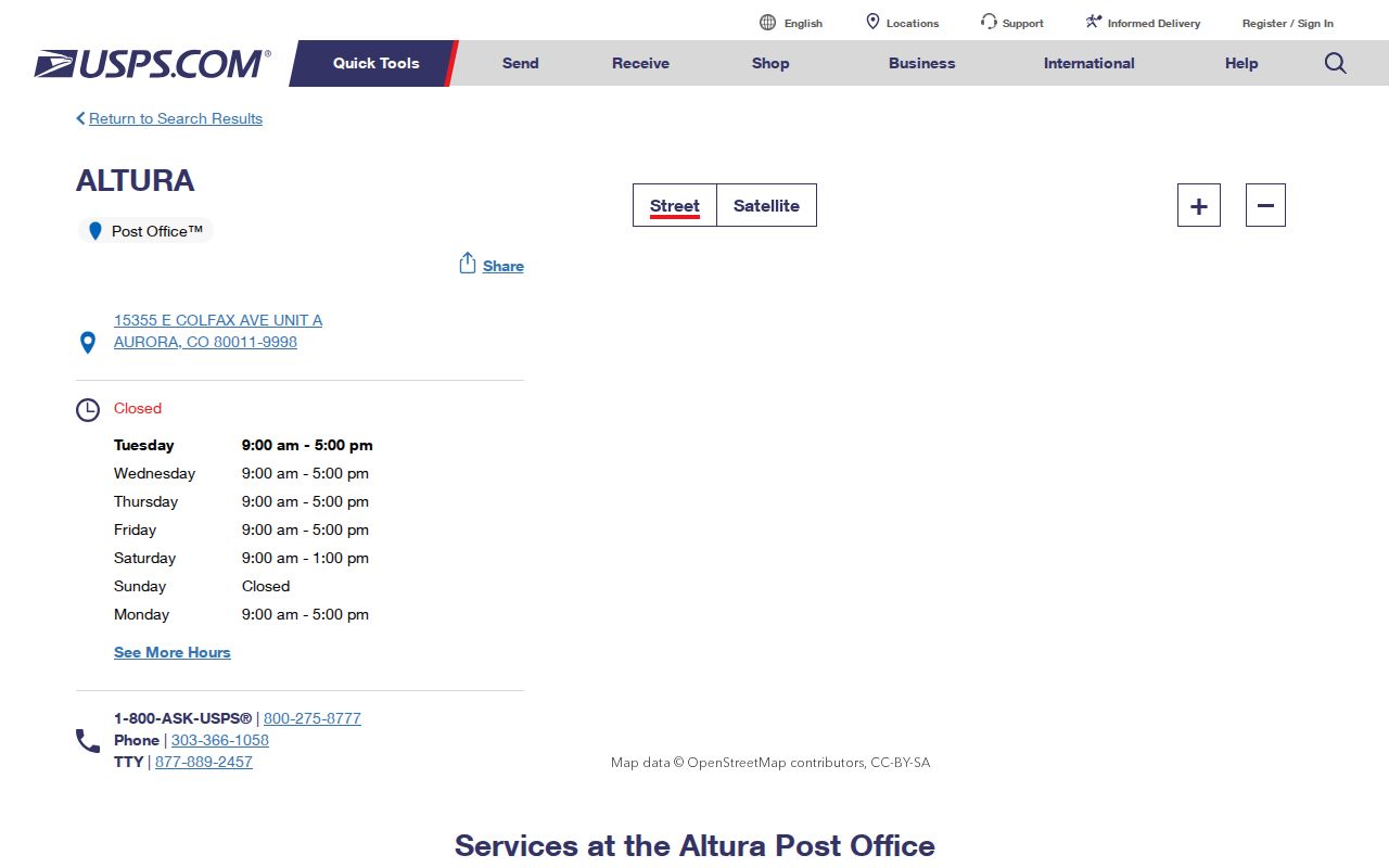
The station example shows how a post-office last line can be tied to a route without becoming a parcel boundary. Check USPS address lookup for the exact delivery assignment, then use the city map and county GIS for legal geography.
For an office or counter question, use the station page for the current location record and the published station route. The research did not locate stable station pages for every regular row, so the table keeps those gaps visible instead of assigning a post office by guess.
Find Aurora ZIP Code Directory Routes
A ZIP-capable search needs a person field and a purpose. The Colorado voter lookup is the clearest official people-record tool because it requires residential ZIP along with first name, last name, and date of birth. It returns a registration match and route, not a bulk resident list. Aurora Police transparency data also accepts ZIP, category, year, police district, ward, beat, and neighborhood, but that tool describes incidents and statistics over a limited historical span, not residents.
| Tool or record | ZIP field and useful result | What it cannot answer |
|---|---|---|
| Colorado voter lookup | First Name, Last Name, Date of Birth, Residential ZIP; match, county, precinct or ballot route | No complete public voter file; protected-voter information is confidential |
| Aurora police transparency | ZIP, category, year, police district, ward, beat, neighborhood; incident context | Not a resident list and not proof of an event involving a named person |
| Aurora property map | Address autocomplete, then parcel, county, lot/block, subdivision and public documents | No ZIP-wide resident result was exposed |
| Arapahoe recorder | Party, document, date and text or OCR options | No ZIP search field; use legal description or party data |
| County GIS | Address, parcel, layers, districts and map browse | No ZIP-wide resident result was exposed |
Use this sequence when a ZIP is the only geographic clue:
- Verify the exact delivery ZIP and last line through USPS. Keep the full address if one is available.
- Use the voter lookup with the legal name, birth date, and residential ZIP. Record only the public match needed for the question.
- Use the Aurora city map or county GIS to identify the situs parcel and county. Do not send an Arapahoe AIN into an Adams or Douglas search.
- Move to the recorder, assessor, permit, or court system using its own key: party, parcel, legal description, case, or address.
- When the question is street-level, carry the verified address into the Aurora street directory workflow rather than assuming the ZIP supplies the answer.
The Colorado Secretary of State address finder is ZIP-adjacent rather than a resident finder. It routes a street address to polling-place and dropbox information, which helps verify election geography but does not identify a household.
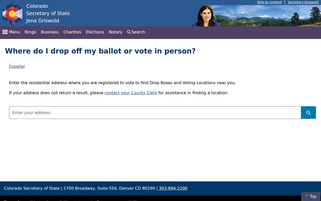
The address-finder capture reinforces the difference between a ZIP-capable civic route and a person record. A ZIP can narrow the search, but it cannot replace a name, parcel, or legal-description key.
Aurora ZIP Terms That Matter
Postal language can look like parcel language when the two systems share a city name. These definitions keep Aurora ZIP terms tied to the right kind of evidence.
- ZIP code
- A five-digit USPS delivery-area label used for routing mail; it is not a legal city boundary.
- ZIP+4
- The four extra digits narrow delivery to a segment, building, floor, or box group within a five-digit route.
- PO-box or auxiliary ZIP
- A route or last-line identifier may serve boxes, an institution, or a special container; the exact local use must be verified.
- Unique ZIP
- A postal identifier assigned to a single institution, organization, or other special delivery use rather than a broad residential area.
- Carrier route
- A delivery sequence within a postal route. It can help USPS sort mail, but it does not list the people served.
Parcel systems use different keys. A situs address marks the physical location. A tax mailing address receives notices. A legal description uses lot, block, subdivision, quarter-section, or metes and bounds. The postal last line uses a city and ZIP that may not follow either boundary. That is why a ZIP result should be carried forward as a routing clue, not copied into a deed or resident conclusion.
Aurora ZIP Codes versus City Limits
A ZIP code can cross the Aurora city boundary, and an Aurora parcel can use a last line or station that does not match the most obvious neighborhood name. The city property map and permits key on situs address and city limits. The assessor keys on parcel, legal, and tax fields. The recorder keys on parties, legal descriptions, dates, and document numbers. The voter portal keys on a person plus residential ZIP. The disagreement is structural, not a data error.
Routing rule. A postal ZIP routes mail. A county polygon routes deeds, tax records, courts, and elections. Confirm both before calling a record an Aurora result.
Aurora's county-split geography is part of the check. Most of the city is in Arapahoe County, while Adams and Douglas portions need their own assessor, recorder, election, and court routes. Use the city map's County and Parcel ID fields, then verify the county GIS and legal description. A city or postal name by itself cannot select the custodian.
Aurora ZIP Without a Resident Total
No official per-ZIP population or registration table, and no city-post-office boundary map, was located for Aurora in the inspected materials. County election statistics can be requested by county or precinct, but they are not the same as ZIP statistics. The absence of a number is therefore a research gap, not permission to estimate a ZIP's residents from postal containers, police incidents, property rows, or voter matches.
For a careful result, preserve the USPS source date, station or last line, full delivery address when available, city-map county, parcel identifier, and the portal that supplied the person match. If a source cannot expose a field, write the gap down and use the custodian's web, phone, email, mail, or counter route. A specific city request can use the Colorado Open Records Act, C.R.S. §24-72-102 et seq.; public-safety records use the CCJRA, C.R.S. §24-72-301 et seq. This keeps the Aurora postal reference useful without turning postal geography into a claim about who lives in a place.